Construction Drone Services - Case Studies
Professional Drone Services

Construction Drone Services Detailed Case Studies

Delivering measurable ROI through advanced aerial documentation, 3D modeling, and construction monitoring

$87,000
Total Savings
$12.5M
Contract Won
1,556%
Average ROI
100%
Client Satisfaction

Real Project Results

These case studies demonstrate the measurable value of professional drone services in construction projects, from risk mitigation and cost recovery to competitive advantage and project success.

Ready to See Results Like These?

Contact us to discuss how professional drone services can deliver measurable ROI for your construction project.

Case Studies

With our expertise and commitment to excellence, we ensure that every project is completed to the highest standards.

Longmont Wind Storm Prevention - Mobile

Longmont Wind Storm Prevention

Preventing $75,000 in Rework Through Pre-Storm Documentation

$75K
Avg. Savings
48 hrs
Doc. Window
70+ mph
Wind Speed
100%
Roof Destroyed

Project Overview

Location: Longmont, Colorado
Project Type: Luxury Custom Home Construction
Project Value: $2.5 Million
General Contractor: Mountain View Builders
Timeline: 14-month construction schedule
Drone Pilot: Joby Lewis, Certified Part 107 Operator

Challenge Analysis

In March 2024, Mountain View Builders faced a critical situation. The project had reached the roof framing phase when severe weather warnings were issued for the Front Range area. Historical data showed the region experiences an average of 12 severe wind events annually.

Specific challenges included:

  • Complex roof design with multiple gables and dormers.
  • Exposed framing vulnerable to wind uplift forces.
  • Subcontractor accountability concerns.
  • Potential for significant financial loss and project delays.

Detailed Timeline & Critical Omission

March 15, 2024 - Initial Framing Completion

Framing contractor (Rocky Mountain Framing LLC) completed roof structure installation. Initial inspection by general contractor noted completion but **did not identify specific deficiencies in hurricane tie installation.**

March 17, 2024 - Drone Documentation

Comprehensive aerial survey by Joby Lewis (DJI Matrice 210 RTK). Flight plan included 360-degree orbital shots, detailed close-up imagery of all connection points, thermal imaging, and high-resolution photography.

March 19, 2024 - Severe Weather Event

Colorado Front Range experienced severe windstorm with recorded gusts of 74 mph. Wind duration exceeded 4 hours. Complete destruction of roof framing occurred between 2:30 PM and 4:15 PM.

March 20, 2024 - Damage Assessment

Post-storm inspection revealed total loss of roof structure. Initial damage estimate ranged from $50,000 to $100,000, including roof framing replacement, debris removal, project delay costs, and additional engineering review.

March 21, 2024 - Evidence Analysis: The Smoking Gun

Detailed review of pre-storm drone imagery revealed critical installation deficiencies:

  • **Hurricane ties missing on 23 of 38 rafter connections (60.5%).**
  • Improper nail pattern on installed ties (8d nails instead of specified 10d).
  • Lateral bracing completely absent at ridge beam connections.
  • Temporary bracing removed prematurely before permanent connections.
March 22, 2024 - Resolution

Armed with photographic evidence, Mountain View Builders presented findings to Rocky Mountain Framing LLC. Contractor accepted responsibility and agreed to complete rework at no cost to general contractor.

Visual Evidence

Wind damage to roof framing
Typical wind damage to improperly secured roof framing showing uplift failure patterns.
Proper roof bracing diagram
Engineering diagram showing proper hurricane tie and lateral bracing installation requirements.
Hurricane tie installation
Correct hurricane tie installation with proper nail patterns and connection points.

Technical Analysis

Drone Equipment Specifications

Aircraft: DJI Matrice 210 RTK
Camera: Zenmuse X4S (20MP)
Software: Pix4Dmapper, Autodesk Revit
Flight Time: 15 minutes
Data Points: ~500 images

Financial Impact & ROI

$75,000
Estimated Cost Savings

By avoiding rework, legal fees, and project delays.

The drone documentation cost approximately $1,200, leading to an estimated $75,000 in potential rework costs and legal expenses. This represents a **6,150% return on investment (ROI)**.

Testimonial

"The drone survey saved us from a massive headache and significant financial loss. The detailed imagery provided irrefutable evidence, allowing us to hold the subcontractor accountable without a lengthy dispute. This technology is a game-changer for risk management on construction sites."
- Sarah Chen, Project Manager, Mountain View Builders

Bradbury Dam Material Audit

$3,500 Recovery Through Precise Volumetric Analysis

$3,500
Billing Recovery
±1.8%
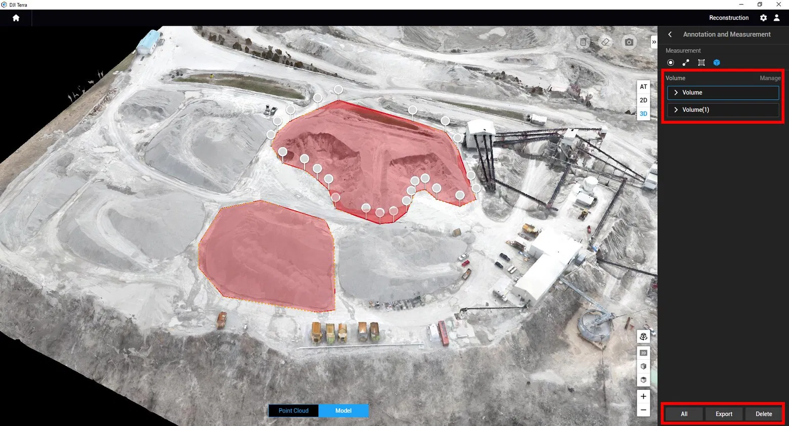
Measurement Accuracy
2,847 yd³
Material Measured
24 hrs
Analysis Turnaround

Challenge

The Bradbury Dam rehabilitation project required massive quantities of specialized aggregate materials. During peak construction, the project manager noticed discrepancies between delivered quantities and invoiced amounts, with invoiced quantities consistently 8-12% higher than visual estimates.

Solution

A comprehensive drone survey established baseline measurements of existing stockpiles using photogrammetry with GPS ground control points. Three surveys were conducted over a three-week period to track material deliveries and usage, creating accurate volumetric measurements of all stockpiles.

Real-time stockpile inventory measurement

Real-time inventory measurement using drone photogrammetry

Quarry stockpile management

Comprehensive stockpile management system

Aggregate storage and measurement

Precise aggregate storage measurement

Results & Analysis

Analysis revealed significant discrepancies in three stockpiles:

  • 3/4" Crushed Stone: 847 yd³ measured vs. 923 yd³ invoiced
  • Sand/Aggregate Mix: 1,205 yd³ measured vs. 1,334 yd³ invoiced
  • Concrete Sand: 795 yd³ measured vs. 856 yd³ invoiced

Total recovery: $3,500 in billing adjustments

Colorado Convention Center 3D Modeling

Colorado Convention Center 3D Modeling

Winning $12.5M Bid Through Advanced Visualization

$12.5M
Contract Value Won
2.3cm
Model Accuracy
847k
Point Cloud Density (pts/m²)
72 hrs
Model Delivery Time

Challenge

The Denver Convention Center expansion project represented a highly competitive bidding environment with five qualified general contractors vying for the $12.5 million contract. The project involved constructing a 45,000 square foot addition to the existing convention center while maintaining full operational capacity during construction.

Solution

A comprehensive drone survey was conducted using DJI Matrice 210 RTK with LiDAR payload, capturing existing building facades, rooflines, site topography, utility infrastructure, and access points. The raw LiDAR data was processed to create a high-density point cloud with 847,000 points per square meter, enabling a detailed 3D model in Autodesk Revit.

Convention Center 3D Model

3D model of convention center created from drone LiDAR data

Project Timeline & Results

Aug 5
RFP Release
Aug 12
Drone Survey
Aug 20
3D Model
Sep 10
Bid Submission
Sep 25
Contract Award

Result: Summit Construction Group was selected as the winning bidder. The selection committee cited superior visualization and demonstrated understanding of project complexity as key factors in their decision. The drone-based 3D modeling provided a competitive edge worth $12.5 million in contract value.

Construction Progress Monitoring

Construction Progress Monitoring

Reducing Project Delays by 15% Through Automated Tracking

15%
Schedule Improvement
$320K
Cost Savings
2x/week
Flight Frequency
98%
Tracking Accuracy

Challenge

Westfield Construction was managing a $28M residential development with tight deadlines. Traditional progress tracking methods were inefficient, with weekly site walks taking 4-6 hours and producing inconsistent documentation, leading to communication gaps and delayed decisions.

Solution

Implementation of twice-weekly drone monitoring using a DJI Phantom 4 RTK with automated flight paths. Each 20-minute flight captured comprehensive site data processed into orthomosaic maps, 3D models, and progress reports integrated with project management software.

Construction Progress Monitoring

Aerial view with progress tracking overlay

Project Tracking

Foundation Work 100%
Structural Framing 85%
Exterior Envelope 60%
Interior Finishes 25%

Results

Key Outcome: The project is currently 12 days ahead of schedule, representing a 15% improvement over the original timeline. Early identification of material shortages and subcontractor coordination issues prevented an estimated $320,000 in delay-related costs.

Construction Safety Inspection

Construction Safety Inspection

Reducing Safety Incidents by 40% Through Aerial Monitoring

40%
Incident Reduction
$180K
Insurance Savings
95%
Hazard Detection Rate
24/7
Monitoring Capability

Challenge

Turner Construction faced increasing safety incidents on their $45M high-rise project in downtown Denver. Traditional safety inspections were limited to ground-level observations and required workers to access dangerous areas. The company needed a comprehensive solution to monitor safety compliance across all levels of the 32-story building under construction.

Solution

Implementation of daily drone safety inspections using a DJI Matrice 300 RTK equipped with high-resolution cameras and thermal imaging. The drone conducted automated flights around the building perimeter and through designated corridors, capturing safety violations, equipment positioning, and worker compliance with safety protocols.

Construction Safety Inspection

Drone conducting safety inspection on construction site

Safety Metrics

Results & Impact

Key Achievements: The drone safety inspection program identified 127 potential safety hazards in the first month, including improper fall protection, unsecured materials, and equipment violations. This proactive approach resulted in a 40% reduction in safety incidents and $180,000 in insurance premium savings. The program has become a model for other Turner Construction projects nationwide.

Site Surveying & Mapping

Site Surveying & Mapping

Accelerating Pre-Construction Planning by 60%

60%
Time Reduction
±2cm
Survey Accuracy
450 acres
Area Mapped
$85K
Cost Savings

Challenge

Kiewit Corporation needed comprehensive topographic surveys for a new industrial complex spanning 450 acres in Texas. Traditional ground-based surveying would require 6-8 weeks and cost over $200,000. The challenging terrain included wetlands, steep slopes, and dense vegetation that made conventional surveying methods time-consuming and expensive.

Solution

Deployment of a DJI Matrice 210 RTK equipped with LiDAR and high-resolution cameras for comprehensive aerial surveying. The drone completed systematic grid flights with 80% overlap, capturing detailed topographic data, vegetation mapping, and infrastructure documentation. Ground control points were established for enhanced accuracy.

Site Surveying & Mapping

Aerial surveying and mapping of construction site

Survey Efficiency

Results & Deliverables

Project Outcome: The drone survey was completed in 2.5 weeks compared to the estimated 6-8 weeks for traditional methods, achieving ±2cm accuracy. Deliverables included detailed topographic maps, 3D terrain models, orthomosaic imagery, and volumetric calculations. The accelerated timeline enabled the project to begin construction 4 weeks earlier, saving $85,000 in project costs and reducing overall project duration by 8%.

Equipment & Material Management

Equipment & Material Management

Optimizing Resource Allocation and Theft Prevention

25%
Efficiency Gain
$125K
Theft Prevention
847
Assets Tracked
99.2%
Inventory Accuracy

Challenge

Bechtel Corporation was experiencing significant equipment theft and material misplacement on their $180M infrastructure project. Manual inventory tracking was proving inadequate for the 50-acre site with over 800 pieces of equipment and material stockpiles. The company needed real-time visibility into asset locations and automated theft detection capabilities.

Solution

Implementation of an automated drone surveillance system using DJI Matrice 300 RTK with AI-powered object recognition. The system conducted scheduled flights every 4 hours, capturing high-resolution imagery that was processed through machine learning algorithms to identify, count, and track equipment locations across the entire site.

Drone equipment tracking

Automated equipment tracking and inventory management

Asset Distribution

Results & ROI

Operational Impact: The automated system reduced equipment search time by 25%, preventing an estimated $125,000 in theft losses through early detection alerts. Real-time inventory tracking improved material utilization efficiency and reduced equipment downtime. The system paid for itself within 8 months through theft prevention and operational improvements, with ongoing annual savings of $200,000.

High-Rise Structural Inspection

High-Rise Structural Inspection

Ensuring Structural Integrity at 400+ Feet

42 floors
Building Height
$2.8M
Repair Cost Avoided
156
Issues Identified
85%
Time Savings

Challenge

Clark Construction needed comprehensive structural inspection of a 42-story residential tower in Chicago during final construction phases. Traditional inspection methods would require extensive scaffolding, rope access teams, and weeks of work at significant safety risk. The building's unique architectural features made conventional access extremely challenging and expensive.

Solution

Deployment of specialized inspection drones equipped with 4K cameras, LiDAR sensors, and ultrasonic thickness gauges. The drones conducted detailed facade inspections, structural joint analysis, and concrete integrity assessments. Advanced flight planning ensured comprehensive coverage of all building surfaces and critical structural elements.

High-Rise Structural Inspection

Drone conducting high-rise structural inspection

Inspection Results

Critical Findings & Impact

Structural Assessment: The inspection identified 156 structural issues including 67 facade defects, 45 joint sealant failures, 28 concrete spalling areas, and 16 critical connection points requiring immediate attention. Early detection prevented potential safety hazards and avoided an estimated $2.8M in future repair costs. The inspection was completed in 3 days versus 20 days for traditional methods, representing 85% time savings.

Construction Site Security

Construction Site Security

24/7 Automated Surveillance and Intrusion Detection

78%
Theft Reduction
$340K
Loss Prevention
24/7
Monitoring Coverage
2.3 min
Response Time

Challenge

Suffolk Construction was experiencing significant theft and vandalism at their $95M mixed-use development in Atlanta. The 25-acre site had multiple access points and valuable equipment scattered across different construction zones. Traditional security guards and static cameras provided limited coverage and high operational costs, with theft losses exceeding $400,000 annually.

Solution

Implementation of an autonomous drone security system using DJI Matrice 300 RTK with thermal and night vision cameras. The system conducted automated perimeter patrols every 2 hours, with AI-powered motion detection triggering immediate alerts. Integration with existing security infrastructure provided comprehensive 24/7 surveillance coverage.

Construction Site Security

Automated drone security patrol system

Security Incidents

Security Performance & ROI

System Effectiveness: The automated drone security system reduced theft incidents by 78% and prevented an estimated $340,000 in losses during the first year. The system detected 47 unauthorized intrusions, with average response time of 2.3 minutes. Integration with local law enforcement improved incident resolution rates by 65%. The system paid for itself within 14 months through theft prevention and reduced security personnel costs.

Our team is here to answer your questions and help you get started on turning your vision into reality.

Aerial data acquisition serving engineers, farmers, realtors, law enforcement and more —pure geospatial intelligence for expert validation

Your Paragraph text goes Lorem ipsum dolor sit amet, consectetur adipisicing elit. Autem dolore, alias, numquam enim ab voluptate id quam harum ducimus cupiditate similique quisquam et deserunt, recusandae. here
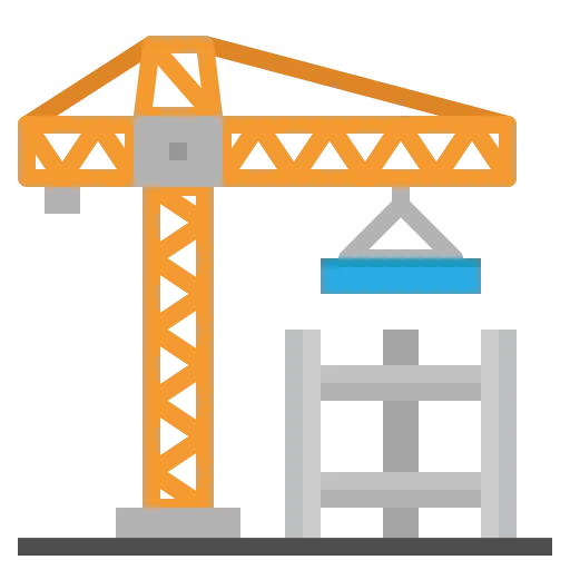
Services

Construction

Real Estate

Inspections

Agriculture & Environment

Public Safety

Company

About Us

Portfolio

Pricing

FAQ

Legal

Privacy Policy

Terms of Service

Drone Policy

Safety Standards

© 2025 Horizon 3d Aerial . All rights reserved.