


Transforming Construction with Advance Drone Technology
Save time, reduce costs, and eliminate risks with our comprehensive aerial construction services
Precision Drone Services
for Construction
Elevate your construction projects with cutting-edge aerial data acquisition and analysis
Key Challenges in Construction Management
Our Construction Services
Pre-Construction Site Analysis
Detailed site mapping, 3D modeling, and CGI overlay for project planning and bidding
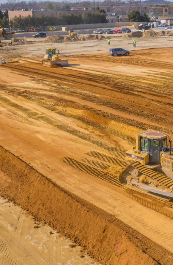
Progress Reports
Comprehensive aerial documentation of construction progress with detailed reports and timeline tracking.
AS-Built Documentation
Precise aerial capture of completed construction projects for accurate as-built documentation and verification.
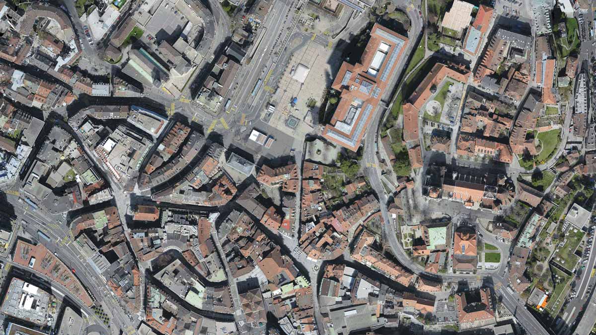
Orthomosaics
High-resolution orthomosaic maps providing detailed aerial views of your entire construction site.
Pre-Construction
Comprehensive aerial documentation of construction progress with detailed reports and timeline tracking.
Progress Reports
Comprehensive aerial documentation of construction progress with detailed reports and timeline tracking.
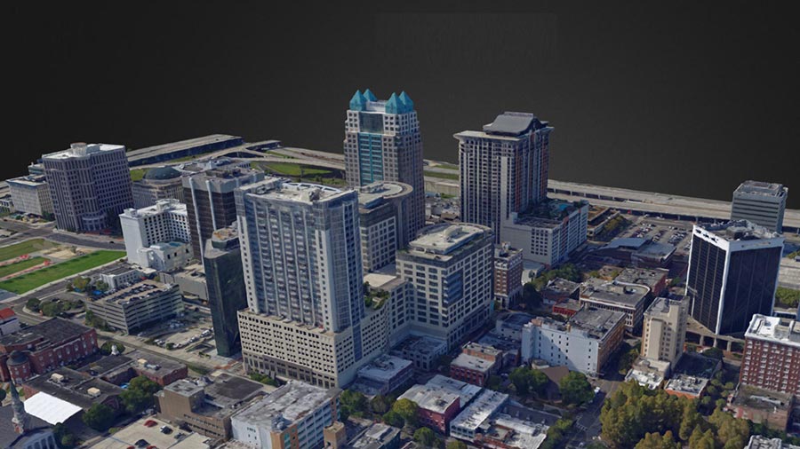
AS-Built & 3D Modelling
Precise aerial capture of completed construction projects for accurate as-built documentation and verification.
Orthomosaics
High-resolution orthomosaic maps providing detailed aerial views of your entire construction site.
Volumetric Analysis
Accurate topographic data acquisition for terrain analysis, volume calculations, and site planning.
Safety & Compliance
Thorough site inspections to ensure safety compliance and identify potential hazards without disrupting operations.
Case Studies
Accurate topographic data acquisition for terrain analysis, volume calculations, and site planning.

Matterport
detailed, immersive digital twin of your construction site—allowing stakeholders to walk the site remotely, review progress, verify work, and resolve issues in real time.

Safety & Compliance
Thorough site inspections to ensure safety compliance and identify potential hazards without disrupting operations. Which includes OSHA compliance monitoring.
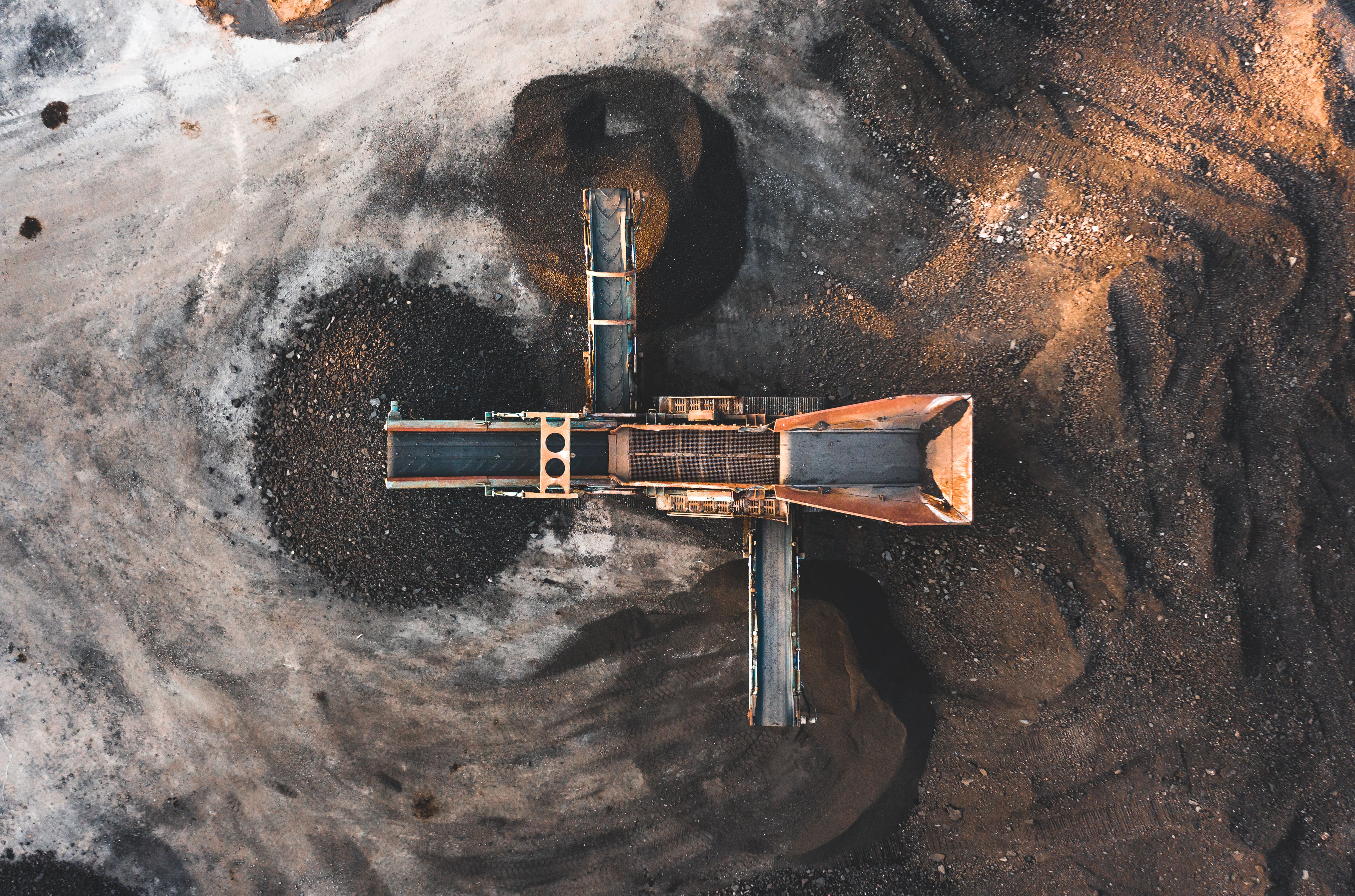
Volumetric Analysis
Raw topographic data acquisition for terrain analysis, volume calculations/ material stockpile measurement, cut/fill calculations, site planning, and delivery verification

3D Modeling & BIM
Advanced 3D modeling integrated with Building Information Management systems

FAA Certified
All our pilots are FAA Part 107 certified and follow strict safety protocols

Industry Experience
Specialized expertise in construction and engineering applications

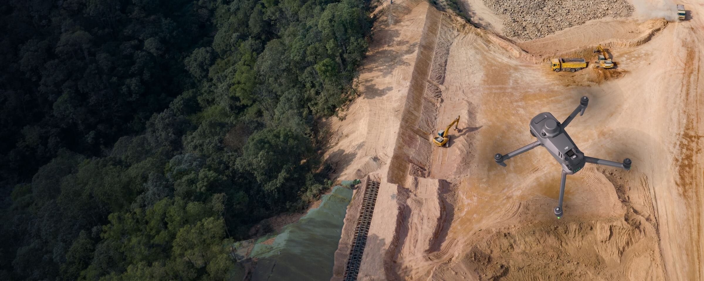
Advanced Technology
Using the latest DJI Matrice 4E drone and industry-leading software solutions
FAA Certified
All our pilots are FAA Part 107 certified and follow strict safety protocols
Industry Experience
Specialized expertise in construction and engineering applications
Advanced Technology
Using the latest DJI Matrice 4E drone and industry-leading software solutions
We use only the very best equipments
At Horizon 3D Aerial, we specialize in providing cutting-edge drone services tailored specifically for the construction and engineering industry. Our team of FAA-certified pilots utilize the advanced DJI Matrice 4E drone and other top-quality drones to deliver precise, actionable data for your projects.

Our team is here to answer your questions and help you get started on turning your vision into reality.
Softwares Used


We generate high resolution outputs for any project and use case
Easily export your digital maps and models to industry-compatible formats for further analysis or reporting
Index Maps
GeoTiff (.tif), .xyz, .las, .laz
Full-color point cloud
.las, .laz, .ply, .xyz
Orthomosaic
GeoTiff (.tif), .kml
Thermal maps
GeoTiff (.tif)
3D textured mesh
.ply, .fbx, .dxf, .obj, .pdf
Services
Construction
Real Estate
Inspections
Agriculture & Environment
Public Safety
Company
About Us
Portfolio
Pricing
FAQ
Legal
Privacy Policy
Terms of Service
Drone Policy
Safety Standards
© 2025 Horizon 3d Aerial . All rights reserved.