


Precision Data Capture
The Unbiased Aerial Standard
FAA-certified aerial data acquisition serving engineers, farmers, realtors, law enforcement and more —pure geospatial intelligence for expert validation
Precision Data Capture
The Unbiased Aerial Standard
FAA-certified aerial data acquisition serving engineers, farmers, realtors, law enforcement and more —pure geospatial intelligence for expert validation
Leading Drone Data & Technology Services

FAA Certified
All our pilots are FAA Part 107 certified and follow strict safety protocols

Industry Experience
Specialized expertise in construction and engineering applications

Advanced Technology
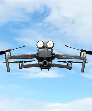
Using the latest DJI Matrice 4E drone and industry-leading software solutions
Note: Our deliverables are for informational purposes only and do not constitute legal, engineering, or surveying documents unless produced in collaboration with licensed professionals.
FAA Certified
All our pilots are FAA Part 107 certified and follow strict safety protocols
Industry Experience
Specialized expertise in construction and engineering applications
Advanced Technology
Using the latest DJI Matrice 4E drone and industry-leading software solutions
Your Trusted End-to-End Drone
Service Provider
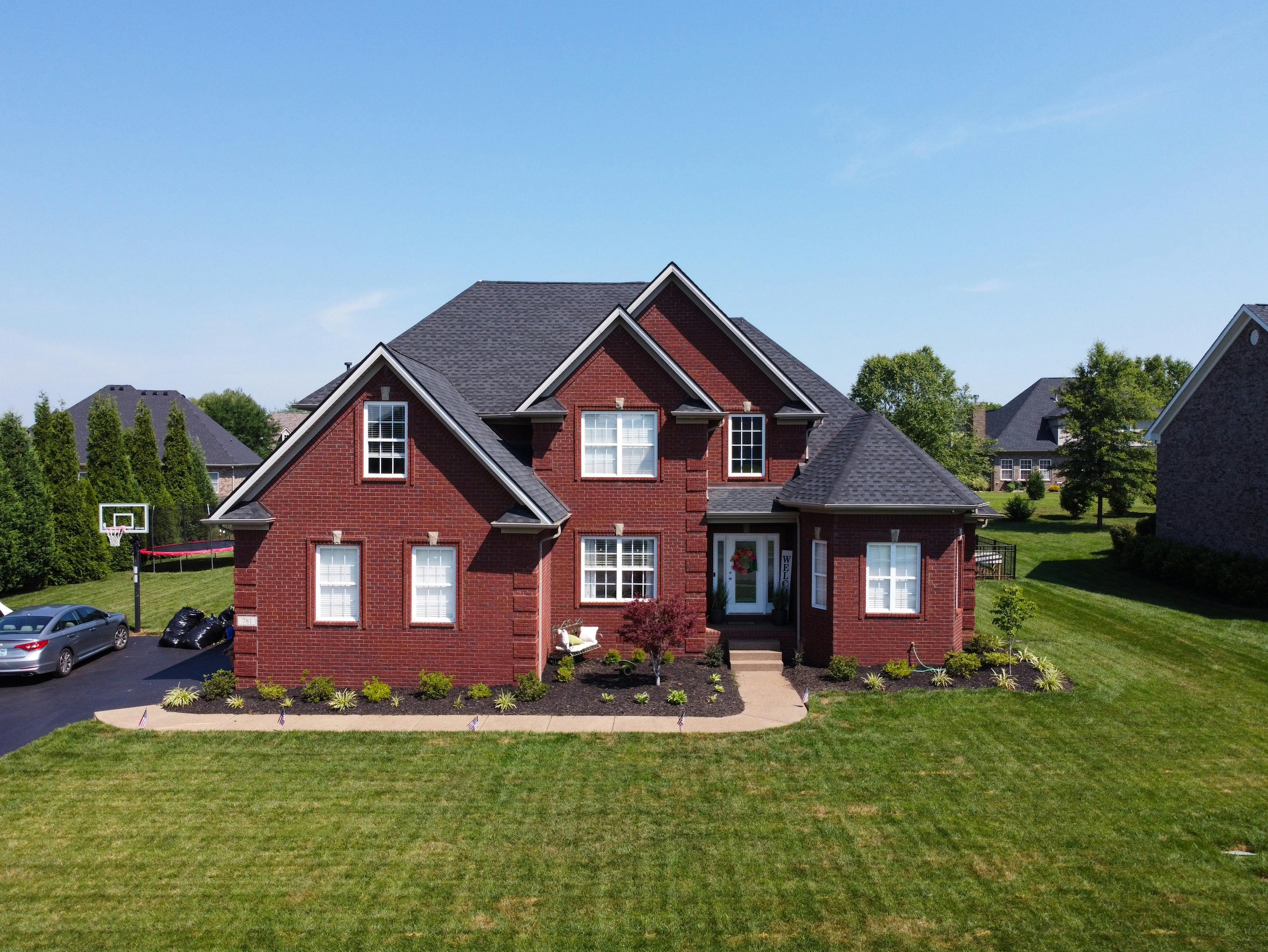
Horizon 3D Aerial is a premier drone services provider specializing in high-resolution aerial imaging, industrial inspections, and 3D data capture for visualization, mapping, and analysis. Our advanced drone technology supports industries such as Construction, Real Estate, Energy, Infrastructure, Environmental Monitoring and other industries. We provide accurate, georeferenced data—processed for client use under the oversight of licensed professionals where required.
We are fully compliant with FAA Part 107 regulations; we prioritize safety and operational excellence in all our operations.
Note: Our deliverables are for informational purposes only and do not constitute legal, engineering, or surveying documents unless produced in collaboration with licensed professionals.
Proudly Serving the following Industries

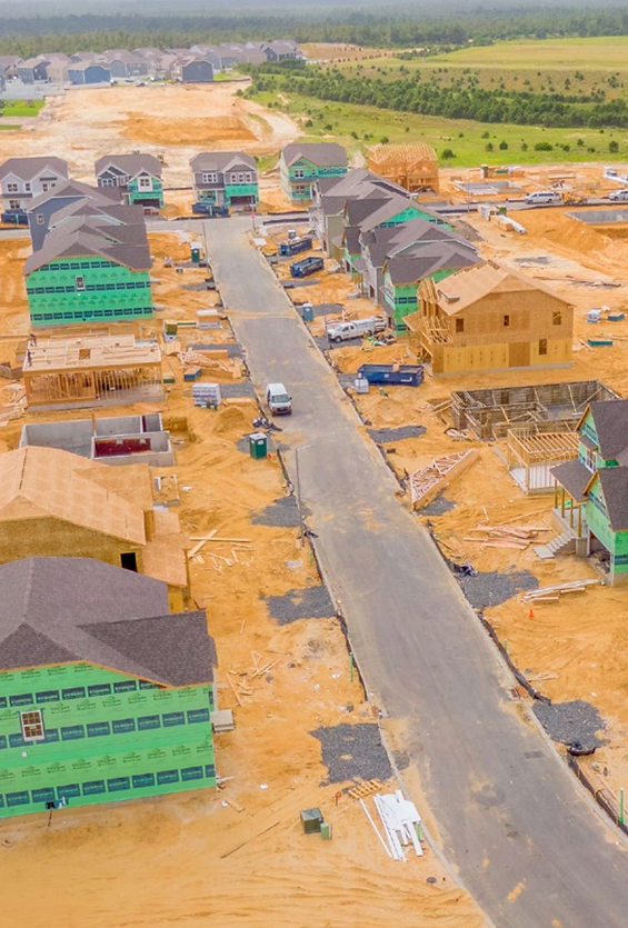
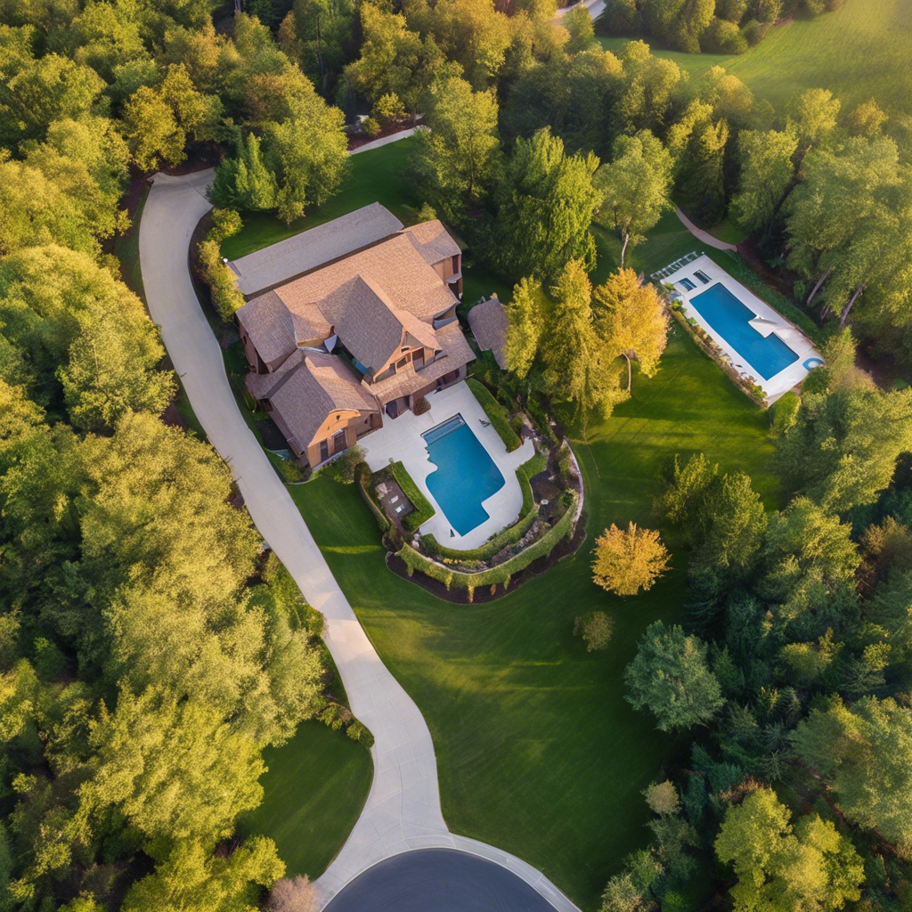
Construction

Real Estate
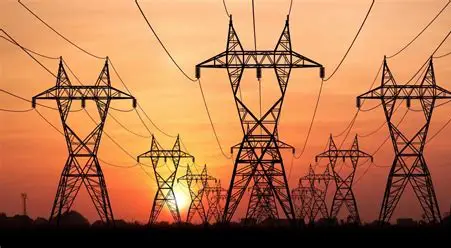
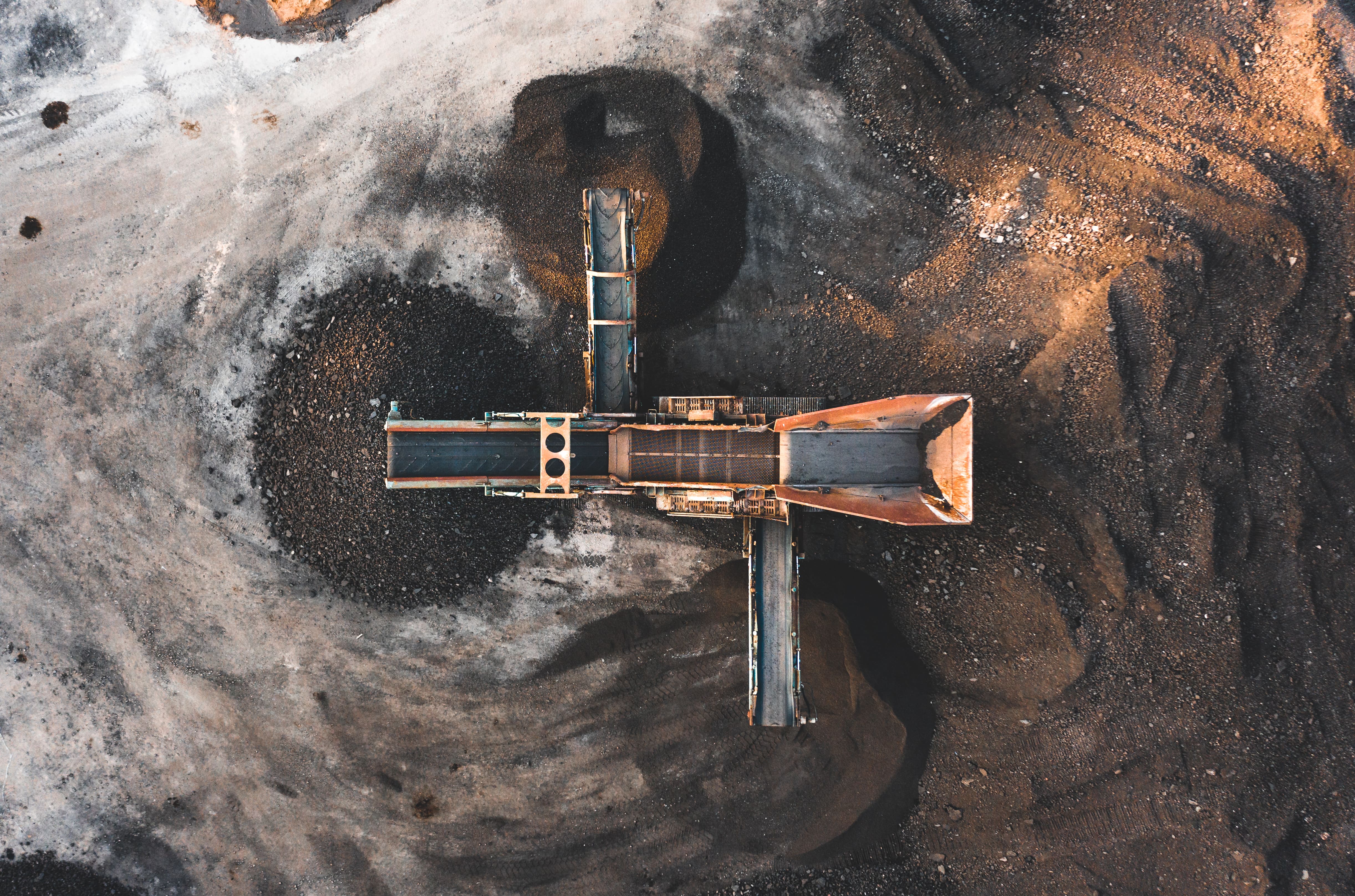
Infrastructures &
Utilities

Public Safety

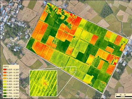
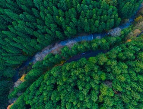
Agriculture & Environment
Proudly Serving the following Industries

Our Services
Comprehensive drone solutions for every industry


We use only the very best equipment
At Horizon 3D Aerial, we specialize in providing cutting-edge drone services tailored specifically for the construction and engineering industry. Our team of FAA-certified pilots utilize the advanced DJI Matrice 4E drone and other top-quality drones to deliver precise, actionable data for your projects.


Softwares Used


Softwares Used
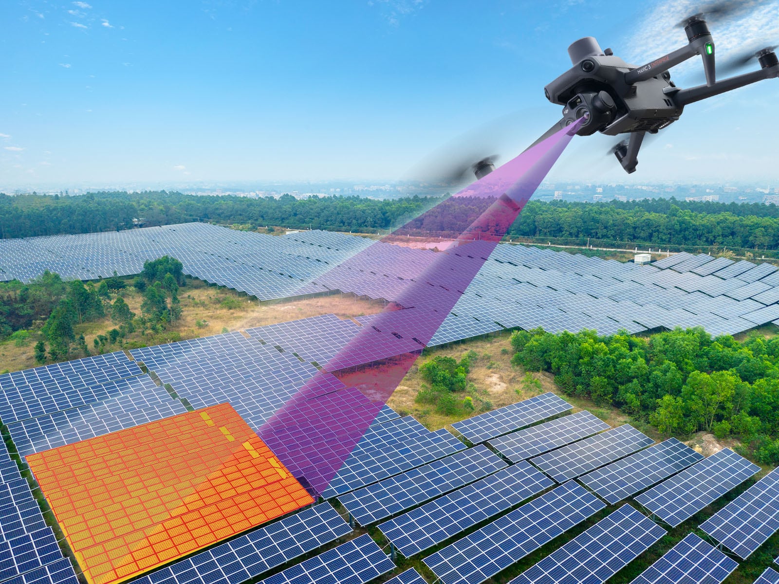
We generate high resolution outputs for any project and use case
Easily export your digital maps and models to industry-compatible formats for further analysis or reporting
Index Maps
GeoTiff (.tif), .xyz, .las, .laz
Full-color point cloud
.las, .laz, .ply, .xyz
Orthomosaic
GeoTiff (.tif), .kml
Thermal maps
GeoTiff (.tif)
3D textured mesh
.ply, .fbx, .dxf, .obj, .pdf
Index Maps
GeoTiff (.tif), .xyz, .las, .laz
Full-color point cloud
.las, .laz, .ply, .xyz
Orthomosaic
GeoTiff (.tif), .kml
Thermal maps
GeoTiff (.tif)
3D textured mesh
.ply, .fbx, .dxf, .obj, .pdf

Our team is here to answer your questions and help you get started on turning your vision into reality.
Aerial data acquisition serving engineers, farmers, realtors, law enforcement and more —pure geospatial intelligence for expert validation
Your Paragraph text goes Lorem ipsum dolor sit amet, consectetur adipisicing elit. Autem dolore, alias, numquam enim ab voluptate id quam harum ducimus cupiditate similique quisquam et deserunt, recusandae. here
Services
Construction
Real Estate
Inspections
Agriculture & Environment
Public Safety
Company
About Us
Portfolio
Pricing
FAQ
Legal
Privacy Policy
Terms of Service
Drone Policy
Safety Standards
© 2025 Horizon 3d Aerial . All rights reserved.